Record added successfully


Ajloun Castle is one of the greatest examples of Islamic Ayyubid military architecture. The first stage of construction began ca.1184 by General Izzidin Usama, nephew of Salahuddin AL Ayyoubi, who built it on a hill 1100 meters above sea level.
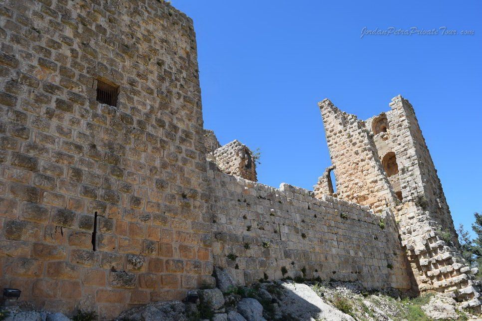
The initial structure consisted of a compact nucleus stronghold with four main towers. Subsequent enlargements followed immediately with the addition of two more towers between 1184 and 1193 AD.
Between 1193 and 1218, during the times of AL Malek AL Adel, the second stage of construction was completed with enlargements by the castle governor Aybak Bin Abdullah. He added and the seventh tower, which wraps around the southeast corner of the building.

Stage three of construction centered on the renewal of the northeast tower when the castle was used as administrative center during the reign of AL Malek AL Nasser Salhudin Yousef between 1250 and 1259.
After Mongol attacks during the reign of the Mamluk Sultan AL Thaher Baybars, restoration of the western part of the castle was undertaken by Amir Izzidin Aybak AL Ala’I between 1259 and 1277, and this concluded the fourth stage of construction.
Ajloun during the Ayyubid and Mamluk periods /The GOLDEN AGE OF AJLOUN
The city of Ajloun witnessed its golden age during the Ayyubid (1171-1250AD) and Mamluk (1250-1517 AD) periods.
At that time it was a center for religious scholarship and a major commercial and agricultural hub known for its abundance of water and strategic location on travel and trade routes.
Such prime positioning promoted Salahuddin to have his commander and nephew Izzidin Usama build a fortress here (Ajloun Castle) in 1194 AD to protect the region against Crusader attacks.
The Ayyubid dynasty, founded by Salahuddin Ayyubi, ruled over a large region covering most of the eastern Mediterranean, parts of North Africa, the Hejaz and Yemen. Jerusalem and the area that is present – day Jordan fell to Salahuddin following his victory over the Crusaders at Hittin in 1187 AD.

The Mamluks, who were war generals serving under the Ayyubids, fought vigorously against the Crusaders in Egypt until they revolted against the Ayyubids in 1250 AD. The Mamluks reached Jordan in 1263 and ruled the area of Ajloun from its fortress. During that time, Jordan was divided administratively between two provinces, Damascus in the north and Karak tower the south.
Between 1193 and 1218, during the times of AL Malek AL Adel, the second stage of construction was completed with enlargements by the castle governor Aybak Bin Abdullah. He added and the seventh tower, which wraps around the southeast corner of the building.
Stage three of construction centered on the renewal of the northeast tower when the castle was used as administrative center during the reign of AL Malek AL Nasser Salhudin Yousef between 1250 and 1259.
Ajloun during the Ayyubid and Mamluk periods /The GOLDEN AGE OF AJLOUN
The city of Ajloun witnessed its golden age during the Ayyubid (1171-1250AD) and Mamluk (1250-1517 AD) periods.
At that time it was a center for religious scholarship and a major commercial and agricultural hub known for its abundance of water and strategic location on travel and trade routes.
Such prime positioning promoted Salahuddin to have his commander and nephew Izzidin Usama build a fortress here (Ajloun Castle) in 1194 AD to protect the region against Crusader attacks.
The Ayyubid dynasty, founded by Salahuddin Ayyubi, ruled over a large region covering most of the eastern Mediterranean, parts of North Africa, the Hejaz and Yemen. Jerusalem and the area that is present – day Jordan fell to Salahuddin following his victory over the Crusaders at Hittin in 1187 AD.
The Mamluks, who were war generals serving under the Ayyubids, fought vigorously against the Crusaders in Egypt until they revolted against the Ayyubids in 1250 AD. The Mamluks reached Jordan in 1263 and ruled the area of Ajloun from its fortress. During that time, Jordan was divided administratively between two provinces, Damascus in the north and Karak tower the south.
EARLY HUMAN SETTLEMENT IN THE CAVES OF AJLOUN
Signs of human habitation in Ajloun date to as early as the Paleolithic Era, around 50,000 years ago.
There are more than 220 archaeological sites in the various eras and one significant early site is the prehi…. AL Hamamah’ caves situated between Wadi Raj…… and Kufranjeh. These caves served as sheiters during hunter-gather periods.
Roman road and infrastructure networks connect Ajloun to the rest of the ancient world
Ajloun was of the Roman Empire’s Arabian (Provincia Arabia) between 63 and 334 AD. Road networks and water infrastructure were a preoccupation of Roman leaders and citizens alike. A milestone dating to 162 AD that commemorates the restoration of the Gerasa – Pella road was recently found at Eshtafana in jabal Ajloun. Milestones were used to mark distances similar to today’s road signs.
EXTENDING OTTOMAN RULE TO THE EMPIRE’S SOUTHERN FRONTIERS
As part of its political and economically –motivated expansion, the Ottoman Empire extended its administrative rule to Trans-Jordan, establishing the area as part of its southern frontiers. East Jordan was under Ottoman rule from 1516 until 1914.
The Ottomans used several strategies to expand their territory, including reconsolidating their presence in Arab provinces and holding back Europe’s expansion into the region. They were responsible for the increase of agricultural productivity in under-populated cultivated regions, and for assuring security in the Arab provinces.
During the first half of the 19th century the villages of Ajloun were politically controlled by a dual authority of local chiefs (za’im) and leading Bedouin sheikhs of various tribes. Each village was appointed a tribal representative to serve as “brother”(akh), and he was responsible for protecting them against outside attack. In return for this service, the Ottomans and “brothers” imposed a tax in the form of wheat, barley and clothing. Unable to afford the tax, many peasants abandoned their villages.
PUBLIC SPACES AND PLACES OF WORSHIP
During Ayyubid and Mamluk times Ajloun witnessed rapid expansion and was a lively center of commerce, agriculture and religious scholarship.
An impressive program was implemented to develop public buildings and spaces, which included specialty markets (souqs), religious buildings, schools and orchards to provide for the town’s growing populace.
Today’s Ajloun city center testifies to this early and progressive public space initiative. An ancient eucalyptus tree venerated for its medicinal and aromatherapy properties marks the heart of central Ajloun. The tree is ringed by the Ayyubid mosque, St.George church, ancient masusoleums , and the vegetable market.

Rural mosques and maqams of Ajloun
There are several historic mosques and mausoleums in Ajloun were used as khanqas , places of religious learning, contemplation and scholarship. These testify to an era of economic prosperity ushered in by the Ayyubid, Mamluks and Ottomans, at which time there was a resurgence in intellectual activity in the Islamic world.
The religious structures no longer serve their original function; today they are simply shrines (maqams) or mazars) that are visited due to their association with religious scholars. Some of the important maqams include Sakhrawi in Sakhra , Ali Al Momani in ‘Ayn Jenneh and ikremah in khirbat Al Wahadneh.
The khanqa of Sidi Bader
The khanqa of Sidi Bader served as place of religious and scientific teaching and scholarship of Sufism during the Ayyubid and Mamluk periods. The khanqa building complex included a small mosque, areas for retreat and contemplation, a kitchen, an oven, a place for ablution and a bathroom.
Khanqas were built as charitable endowments (waqfs) and each khanqa was assigned a scholar to maintain it. Some of the renowned Sufi scholars that resided in Ajloun include Mohammad Bin Ali Ja’far Al Ajlouni and Omar Bin Hatem Al Ajlouni.
A MOUSQUE IN USE FOR CENTURIES
The Ayyubid Mosque of Ajloun is the only mosque in Jordan that has continuously been in use since it was built.
It is one of the oldest mosques in the country, dating back to the Ayyubid /Mamluk period. King Al Saleh Najm al Din Ayyub ordered its construction in 1247 AD /645H under the supervision of his deputy Amir Al’a Al Din Aydikin AlBundiqdar.
It is located in the city center overlooking the main marketplace. The architectural layout is typical of the period and consists of an indoor prayer hall and outdoor court and minaret. Charitable endowments made possible the addition of a school (madrassa) in the outer court of the mosque- the Yaqiniyyah School.
The Prayer hall
The mosque’s prayer hall is an interesting multi-level space. The structure consists of a series of cross-vaults that create a spiritual space that is both quaint and sublime. Eight stone columns provide structure support as well as refuge for worshippers.
The mosque’s minaret: one of the oldest in Jordan
The minaret of this mosque, built 17 years after its inception in 1263 AD, was ordered by the Mamluk ruler Al Dhaher Baybars as a token of his appreciation and respect for the people of Ajloun, whom he had got to know and love when he resided there in 676 AD. The minaret is 22meters high and is one of the oldest remaining minarets in Jordan. The minaret’s architectural style is similar to others built in the region during the Ayyubid/Mamluk period.
TRADITIONAL AJLOUN HOUSES NESTLED WITHIN ORCHARDS
The communities of Ajloun live in traditional stone houses nestled between olive and fruit orchards. This creates a unique and interactive fabric where social events that involve meals, singing and storytelling are hosted in the orchards.
Residential neighborhoods in Ajloun: Coexistence and tolerance
Ajloun’s communities are a mix of Muslim and Christian families who live in harmonious co-existence. Each residential neighborhood is mainly inhabited by members of the same clan. However, this is starting to change due to migration from and to Ajloun.
Some neighborhoods are named after significant religious or other monuments. For example, Dayr al Room neighborhood is named after the Orthodox Church and Al Jami’ neighborhood is named after the Ayyubid mosque.
Hospitable architecture in Jordanian villages
Jordan’s tradition of hospitality is not limited to the Bedouin nomads; it is a custom in towns and cities throughout the country. Many towns, similar to Ajloun, are dotted with buildings that were constructed for the purpose of hosting guests, and these are called ‘madafas’
The honor of hosting the madafas was given to family or clan leaders. Madafas were located in a prominent part of the house and had various functions. These ranged from gathering family members under one roof and encouraging collaboration within the society to guests during feasts or holidays, exchanging social services and offering help to the public. They were also a place for solving disputes within the community. One significant madafa in Ajloun that has retained its historical structure and role within society is located in Ayn Jannah.
MOUNTAINS, VALLEYS AND SPRINGS
Ajloun’s beautiful natural landscapes roll from altitudes of 1200 meters above sea level, such as Mt.Ras Munif and Mt. Umm Daraj, down to steep valleys that descend sharply toward the River Jordan.
Several valleys crisscross Ajloun from east to west, including Wadi Al Yabis and Wadi Ajloun –Kufranjah. The city itself is situated at the convergence of two valleys (Wadi Al Jude and Wadi Jannah). The abundance of springs in the area has long attracted people to live here, as they pour life into the valleys. ‘Ain ‘ is the Arabic word for ‘spring’; Ain Al Tais is in Ajloun and Ain Al Qantara at the city center next to the Ayyubid Mosque.
Water mills of Ajloun
The Ajloun –Kufranjah valley is known as Wadi Al Tawaheen (valley of the mills) for the plethora of Mamluk and Ottoman watermills found there. These water-powered grain mills along with cultivated sloping terraces reflect a notable industrial and agricultural heritage.
The ancient industrial watermills of Ajloun were an integral part of cereal and grain agricultural in Jordan. Built of local limestone, traditional mills transformed the energy of falling water into kinetic power to turn the wheels that milled the grain.
Farmers in Ajloun cherished their land, their produce and the water mills. A group of local masons were specialized in building mill towers and houses for the milling mechanisms. The production of grain supported a subsistence economy where the main consumers were the producers. In the 20th century, the mills of Wadi Al Tawaheen were gradually replaced by steam mills, yet some traditional mills continued to be used up to the Second World War.
The millstone: a cherished relic and artifact from the past.
The grinding stones were the most valued and expensive part of the mill apparatus and were salvaged by farmers after the mills were abandoned. They were re-cut into smaller stone hand-mills for household use. Millstones were made of basalt and transported by camel from the volcanic plateau of Hauran in southern Syria.
THE STORIES BEHIND THE NAME
Ajloun has a rich history that stretches over more than a hundred thousand years.
"Ajloun" is Semitic / Aramaic name from the root word "ajal", which refers to a round sloping place and can also mean a calf. Historic sources indicate that a 9th century BC Moabite king was named Ajloun. Byzantine era records also mention "Ajloun" in reference to a priest who resided is a monastery on the top of Mount Awf, which is where Ajloun Castle sits today.
Ajloun through the eyes of travelers
Arab and European travelers have been passing through Ajloun for more than a thousand years. Their accounts offer vivid description of the city and its suburbs.
A traveler from Andalusia, Benjamin Bin yaneh Al Tatly, visited Ajloun between 1165 and 1173 and described is as a spacious city with an abundance of water and orchards. The Arab traveler Shams al Din Dimashqi , who died in 1326 AD, remarked that it was a city with abundant fruit and running water, and that a citadel that could be seen from a distance of four days travel. The Muslim traveler Ibn Battutah described is as a beautiful city with many markets, a huge castle and running river.
The Swiss traveler and orientalist Johann Ludwig Burckhardt, who is credited with the European discovery of Petra, passed through Ajloun in 1812 and described its people and their way of life. in 1886, American civil engineer (of German origin) and archaeologist Gottlieb Schumacher visited Ajloun when he was asked by the Palestinian Exploratory Fund to survey the Golan, Hauran and Ajloun districts in preparation for the construction of the Damascus-Haifa railway. An important figure in early archaeological explorations of the region. Schumacher produced the first accurate maps of the area along with detailed description of the archaeological remains and the contemporary villages that existed
WORKING AND HARVESTING THE LAND
During the Mamluk period in Jordan there was a strategic shift in emphasis from fortification and defense to urban and agricultural development.
Farmsteads and stables emerged in abundance during the 14th century. In the 19th century Ottoman villages produced cereals, wheat, barley and vegetables for domestic use. Cash crops differed across regions, with wheat and lentils grown in the plains and mainly olives and vines in the mountain villages. In 1901 Ajloun was one of the most productive districts in the Hauran region.
Harvest time was a period of hard work and contemplation where farmers usually left their homes and slept in small humble structures called al Mantarah, which were constructed in the middle of agricultural fields, to watch over the land and to contemplate before the harvest.
The Olive Harvest
The local “Nabali” olives of Ajloun are famous for their juiciness and are believed to produce one of the highest quality olive oils in the world. Many olive trees in this area are said to be hundreds of years old. Some trees are even close to 2000 years old, which is why Ajloun’s olive trees are known locally as ‘Roman Olives’ in reference to the area’s history of ancient Roman civilization and cultivation. The olive tree has been cultivated for olive oil, fine wood, olive leaf and the olive fruit and residential neighborhoods all over Ajloun are interspersed with olive orchards.
The olive harvest in Ajloun is celebrated through a traditional festival that lives on today in every olive orchard in the area, engaging men and women of all ages.
Local industry in present- day Ajloun
During the Ottoman period local skills and craftsmanship centered on meeting the domestic and commercial needs of a vibrant agricultural community. There were veterinarians and blacksmiths in every town. Other craftsmen included shoe makers and weavers of mats, ropes, clothes and other basic items. Copper workers created plates, cups and decorative items. Women were responsible for weaving wool items such as cushion covers, rugs, saddlebags, belts, tents and more, using ground looms.
Traditional olive pressing was one of the most important local industries. The olive press was, and still is, a common sight in Ajloun.
The oldest church in Ajloun
Maqateh, an area in Ajloun, is home to the oldest church and mosaic in Ajloun (Maqateh Church), which is from 482 AD during the Byzantine era. The data was found in a Greek inscription found there tht mentions a local priest named Ayyub, along with other clergy who donated money to build the church.
Our Lady of the Mountain Church
Ajloun is home to a significant place of pilgrimage, the Our Lady of the Mountain Church in Anjara. This church marks the location of a rebuilt cave that is venerated as a place where Jesus Christ and his mother Mary passed during their journey to the Sea of Galilee (Lake Tiberius). The Vatican designated Anjara as a Millennium 2000 pilgrimage site.
Ajloun City
Ajloun is a remarkable place that clearly illustrates the connections between the land, its people, and the cultures that have created its rich history. Located in the highlands 70 kilometers northwest of Amman, Ajloun is a green escape. It is a crossroads where people of several cultures have met, from the early Christians to the Mamluks, from Saladin s nephew Izz ad-Din Usama to King Abdullah I. Today, Ajloun is an agricultural community with an immense pride in the RSCN s Ajloun Reserve and a deep interest in the ruins and archeological sites being excavated in the region.
This region has been inhabited since Neolithic times. While Ajloun was not one of the cities of the Decapolis, it benefited from its proximity to several of them, including Gadara (Umm Qais), Pella (Tabaqat Fahl), Gerash (Jerash), and Philadelphia (Amman). The number of early churches and Biblical sites here speak to the importance of the area. Saladin s nephew built his castle in the late 1180 s to protect the iron mines from the Crusaders and in the 16th century, the devout Muslim poet and calligrapher Aaysha Baounieh lived in the village of Baoun. King Abdullah I would often come to Ajloun to rest under his favorite tree.
While most tourists know of the Islamic Ajloun Castle, there are a number of other interesting sites. Mar Elyass, site of one of the earliest churches in Jordan, is a lovely hike from the Ajloun Reserve, which is home to roe deer, hyenas and eagles. St. George s Byzantine Church in Rajib boasts lovely mosaics and in the center of Ajloun village, the minaret of the central mosque is over 600 years old.
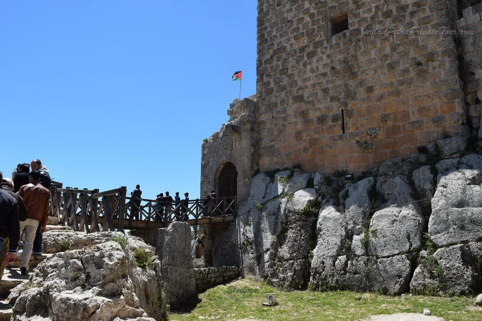
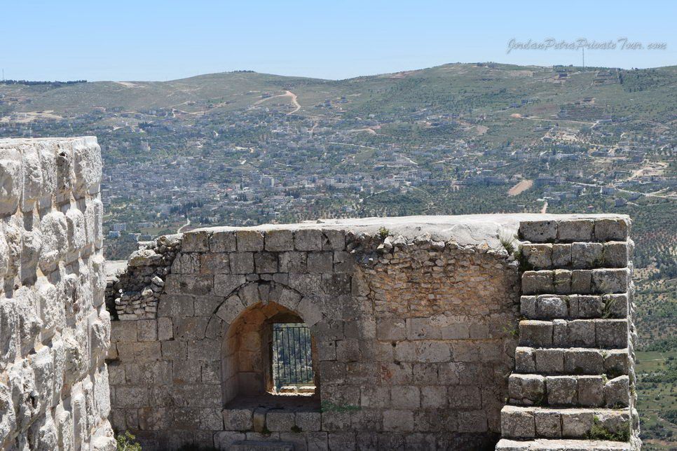
The Saracen Qala at ar-Rabad, built by Saladin s nephew, Izz ad-Din Usama, was built between 1184 and 1188. The castle served as Saladin s base as he evicted the Crusaders from Jordan in 1189. Located on the summit of Mount Auf about 1200 meters above sea level the original castle had four towers protected by a moat about 16 meters wide. Its commanding position allows views over Wadi Kufranjah, Wadi Rajeb and Wadi Al-Yabes, as well as over the Jordan Valley and Lake Tiberias, providing an important defensive advantage. It served as a check to the Crusader Belvoir Fort in Israel and was part of the messenger system of beacons and carrier pigeons that carried news from Damascus to Cairo in only one day.
The castle was taken over by the Mamluks after the death of Izz ad-Din Usama, and in 1214 Aibak ibn Abdullah carried out renovations, including the addition of two new towers. In 1260 the castle was destroyed by the Mongol invaders, but was almost immediately rebuilt. Earthquakes damaged the castle in 1837 and 1927, but it is currently being restored. It is one of the best examples of Arab military architecture in the Levant.
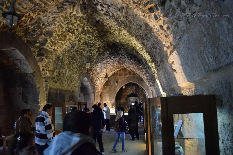
After walking across the bridge over the dry moat, walk through the doorway into the main body of the castle. Don t miss the carvings of the pairs of birds, indicating the importance of carrier pigeons to its history. The galleries and rooms form a warren to wander through, with fabulous glimpses of the surrounding countryside visible from every arrow slit. Architectural features such as the gap in the ceiling for pouring boiling oil, and the storehouses of stone catapult missiles, allow the imagination free rein. It is worth climbing to the top of the castle for the views and an interesting sight of the shape of the castle. RSCN has a guided hike here from the Ajloun Reserve, which provides not only an interesting walk through the region, but also a unique
Kaneesit Mar Elyass, or St. Elijah s Church, has been known as a sacred place for many years. Excavations carried out in the late 1990s uncovered a Byzantine cross-shaped building measuring 33 x 32 meters, with mosaic floors covered in geometric or floral designs. One mosaic states in red letters that the presbyter Saba and his wife offered the church as an expression of their faith in the year 622 AD. Another smaller room has a mosaic floor and cultural artifacts that date from the 2-3rd century.
Outside the church are several trees covered with strips of cloth. Local Christians and Muslims frequently visit the site and many leave the strips as an expression of faith. Elijah the Tishbite is a prophet in the Bible and is recognized as "an honorable man" in the Our an. In Islamic tradition, Elijah is associated with the prophet Khider, who was also lifted to heaven. The two prophets are said to meet every year in Mecca during the Hajj.
Mar Elyass has played an important role for centuries. There are stories of shepherds leading their flocks around the hill if the livestock became ill with the raja virus. The flocks were cured within the week. Local tribes mediate disputes here. Archeological activities are being carried out sensitively here, in recognition of the active role that Mar Elyass still plays in the community.
RSCN s Ajloun Reserve is located on 13 acres of oak, pistachio and carob trees, with seasonally available tents, cabins and a center for education. Several hikes are available, including the guided hike to Mar Elyass and its continuation to Ajloun Castle. Another guided hike climbs up to the eagle habitat, down to the RSCN community based soap factory in Ourjan, and then to a delicious lunch hosted in one of the local farms.
At its highest point, Ajloun sits 1500 meters above sea level; in the adjacent Jordan Valley, the land drops to 412 meters below. The drama of the area, its bio-diversity and the connection of the people to the area make this a memorable place to learn about the rich history Jordan has to offer.